Jurisprudential Evolution of Maritime Boundaries: Comparing ICJ and ITLOS Decisions
An analysis of how ICJ and ITLOS landmark decisions established the three stage delimitation methodology under UNCLOS to resolve international maritime boundary disputes.
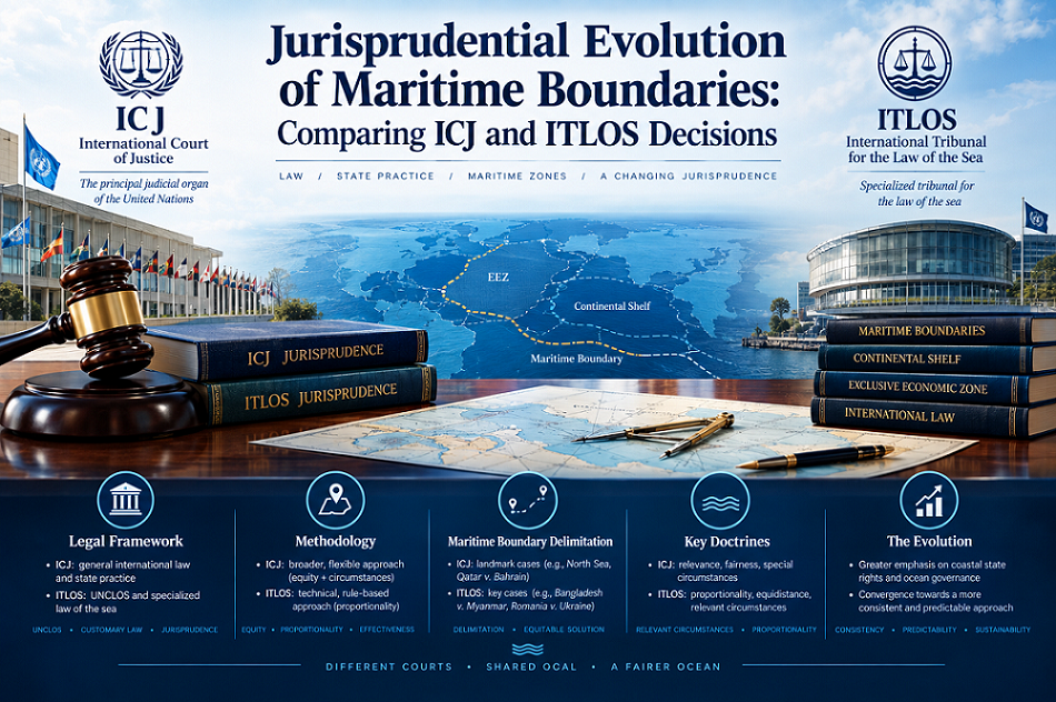
Ocean spaces cover more than seventy percent of the surface of the earth, containing vast mineral wealth, living resources, and vital trade routes. As coastal states expanded their sovereign claims outward during the twentieth century, the need for clear legal boundaries became paramount. International maritime boundary delimitation represents one of the most sophisticated domains of public international law. At the center of this legal framework stand two prominent judicial bodies: the International Court of Justice, based in The Hague, and the International Tribunal for the Law of the Sea, located in Hamburg.
Over several decades, jurisprudence from both tribunals has transformed maritime boundary setting from an unpredictable exercise governed by vague equitable notions into a structured, methodology-driven legal process. This article examines the landmark decisions delivered by the International Court of Justice and the International Tribunal for the Law of the Sea, tracing the evolution of maritime delimitation jurisprudence, analyzing the standardized judicial steps, and exploring how these bodies handle emerging challenges such as extended continental shelf claims.
How do international courts delimit maritime boundaries?
Maritime delimitation is the process by which legal boundaries are established between overlapping maritime entitlements of neighboring coastal states. Under the United Nations Convention on the Law of the Sea, states enjoy specific sovereign rights and jurisdiction across various maritime zones, including the territorial sea, the contiguous zone, the exclusive economic zone, and the continental shelf. When coastal configurations cause these entitlement areas to overlap, judicial intervention or bilateral negotiations become necessary to draw a definitive dividing line.
The legal basis for judicial delimitation differs depending on the maritime zone in question. Article 15 of the United Nations Convention on the Law of the Sea addresses the territorial sea, establishing a default rule based on the median line or equidistance line, unless historical titles or special circumstances warrant a different course. Conversely, Articles 74 and 83 govern the delimitation of the exclusive economic zone and continental shelf, respectively. These provisions stipulate that boundary agreements must achieve an equitable solution, though they purposefully omit a detailed prescription of the exact technical steps required to reach that outcome.
Early international jurisprudence reflected this statutory flexibility, often leading to inconsistent judicial decisions. In the landmark North Sea Continental Shelf cases of 1969, the International Court of Justice emphasized that delimitation must be effected by agreement in accordance with equitable principles, taking into account all relevant circumstances. However, the lack of an objective starting point produced legal unpredictability during the 1970s and 1980s. Over time, international tribunals recognized the need to balance equitable flexibility with legal certainty, establishing a predictable judicial framework that now governs all contemporary maritime boundary litigation.
How does the three stage approach work in maritime delimitation?
The modern era of maritime boundary jurisprudence reached its defining moment in the 2009 Maritime Delimitation in the Black Sea case between Romania and Ukraine. In this unanimous decision, the International Court of Justice formally articulated a standardized three stage methodology for delimiting the exclusive economic zone and continental shelf. Subsequent decisions by both the International Court of Justice and the International Tribunal for the Law of the Sea have cemented this method as a binding standard under customary international law.
The three stages operate sequentially to guarantee both objectivity and equity:
- Stage One: The Provisional Equidistance Line. The tribunal constructs an objective line using geometric baselines derived from the relevant geography of the coastal states. This provisional line consists of points equidistant from the nearest baseline points on the coasts of the contestant nations.
- Stage Two: Adjustment for Relevant Circumstances. The court examines whether specific geographical or historical factors require an adjustment of the provisional line to achieve equity. Such factors may include coastal concavity, marked disparities in coastal lengths, or the presence of small offshore features.
- Stage Three: The Disproportionality Test. The tribunal conducts a final check to verify that the mathematical ratio between coastal lengths and allocated maritime space does not result in gross inequity.
This structured framework was reaffirmed by the International Court of Justice in cases such as Peru v. Chile in 2014 and Nicaragua v. Colombia in 2012. By standardizing the methodology, international courts have dramatically reduced judicial discretion and provided coastal states with a predictable legal climate.
What is the difference between ICJ and ITLOS in maritime delimitation?
While both the International Court of Justice and the International Tribunal for the Law of the Sea possess authority over maritime boundary disputes, they differ in institutional structure, history, and specialization. The International Court of Justice is the principal judicial organ of the United Nations, handling broad international disputes involving territorial sovereignty, treaty interpretation, and state liability. In contrast, the International Tribunal for the Law of the Sea is a specialized judicial body established specifically under the United Nations Convention on the Law of the Sea to resolve ocean disputes.
Despite these institutional distinctions, there is remarkable convergence and harmony between the two legal bodies. The International Tribunal for the Law of the Sea delivered its first full maritime boundary judgment in the 2012 dispute between Bangladesh and Myanmar in the Bay of Bengal. In this historical decision, the specialized tribunal explicitly adopted the three stage methodology pioneered by the International Court of Justice, demonstrating that both institutions apply a unified legal regime.
| Feature | International Court of Justice | International Tribunal for the Law of the Sea |
|---|---|---|
| Primary Mandate | General public international law matters | Specialized law of the sea interpretation |
| Foundational Text | Statute of the International Court of Justice | United Nations Convention on the Law of the Sea |
| Delimitation Method | Three stage methodology | Three stage methodology |
| Technical Expertise | Relies on appointed external hydrographers | Utilizes internal technical experts and assessors |
Subtle operational differences do exist. The International Tribunal for the Law of the Sea frequently utilizes specialized technical assessors and hydrographers directly during proceedings, reflecting its explicit focus on technical ocean matters. Furthermore, the tribunal has shown an early willingness to address complex outer continental shelf claims, prompting similar developments in the jurisprudence of the International Court of Justice.
How are extended continental shelf boundaries delimited?
Under Article 76 of the United Nations Convention on the Law of the Sea, coastal states possess a natural prolongation of their land territory that may extend beyond two hundred nautical miles from their baselines. Delimitation of this extended continental shelf presents unique legal and scientific challenges, as it involves areas where the rights of neighboring states intersect with the mandate of the Commission on the Limits of the Continental Shelf.
For decades, international courts hesitated to delimit the continental shelf beyond two hundred nautical miles prior to the Commission issuing formal recommendations regarding the outer limits of the shelf. However, a major breakthrough occurred in the 2012 Bangladesh v. Myanmar case before the International Tribunal for the Law of the Sea. The tribunal concluded that it possessed jurisdiction to delimit the extended continental shelf even in the absence of finalized recommendations from the Commission, provided that the physical existence of a continuous continental shelf extending beyond two hundred nautical miles was scientifically indisputable.
This landmark approach was quickly reinforced by the Annex VII Arbitral Tribunal in the 2014 decision between Bangladesh and India, as well as by the International Court of Justice in the 2021 judgment in the dispute between Somalia and Kenya. These rulings established that judicial bodies can apply the standard three stage methodology to the extended continental shelf, drawing a single continuous line that governs both the inner two hundred nautical mile zone and the seabed beyond. This jurisprudential advancement prevents prolonged legal uncertainty in energy-rich deepwater areas, enabling states to exercise sovereign rights over natural resources peacefully.
What role do equitable principles play in maritime boundary disputes?
Equitable principles have evolved from a subjective standard into a structured element within modern maritime jurisprudence. In early decisions, such as the 1982 Continental Shelf case between Tunisia and Libya, equity was interpreted as achieving a fair result through whatever legal criteria the court deemed appropriate. This approach faced criticism for prioritizing judicial discretion over predictable rules.
In modern boundary jurisprudence, equitable principles do not grant judges free rein to redistribute ocean space or remedy economic inequalities between nations. Courts have repeatedly affirmed that delimitation is not an exercise in equity in the abstract or wealth redistribution. Socioeconomic factors, such as relative national poverty or historical fishing patterns, rarely result in adjustments to the provisional line unless they are directly linked to geography or long-standing historic title.
Delimitation is not an exercise in dividing ocean space according to abstract notions of distributive justice, but rather a geographic and legal process aimed at achieving an equitable result grounded in coastal realities.
Instead, equity operates primarily as a corrective geographical tool during the second stage of the three stage methodology. Equitable principles serve to smooth out extreme geographical anomalies, such as an isolated small island situated on the wrong side of an equidistance line, or an unusual coastal concavity that would cut off a state from its natural maritime projection. By anchoring equity within an objective geometric framework, the jurisprudence of both the International Court of Justice and the International Tribunal for the Law of the Sea ensures that fairness remains grounded in physical reality.
Key Cases Shaping Modern Jurisprudence
Several milestone decisions highlight this legal transformation:
- North Sea Continental Shelf Cases (1969): Established the foundational role of equitable principles and coastal prolongation under customary law.
- Jan Mayen Case (1993): Introduced an early two-step framework balancing equitable placement with geographic circumstances.
- Qatar v. Bahrain (2001): Clarified the baseline rules for low-elevation rises and island features.
- Black Sea Case (2009): Formally established the binding three stage methodology used today.
- Bangladesh v. Myanmar (2012): Confirmed judicial authority to delimit extended continental shelf areas beyond two hundred nautical miles.
- Somalia v. Kenya (2021): Applied the three stage approach to complex multi-layered ocean zones off the East African coast.
Conclusion
The jurisprudence of the International Court of Justice and the International Tribunal for the Law of the Sea has turned a historically volatile domain of international law into a predictable, rule-based regime. Through the development and consistent application of the three stage methodology, international judges have successfully harmonized equitable considerations with geographical geometry. Whether resolving territorial sea disputes or mapping extended continental shelf boundaries, these decisions provide coastal nations with clear legal principles to resolve maritime disputes peacefully. As climate change, rising sea levels, and shifting baselines pose new legal challenges, the robust jurisprudence developed by these international judicial bodies will remain the cornerstone of global maritime order.
Comments
No comments yet.