The Blue Boardrooms: Sovereign Rights and Delimitation in Enclosed and Semi-Enclosed Seas
Navigating overlapping claims in narrow waterways requires a delicate balance of international law, geographic equity, and diplomatic cooperation under UNCLOS.
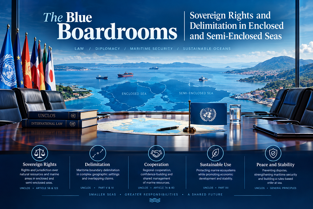
In the expansive domain of international maritime law, the division of ocean spaces is rarely straightforward. While open oceans offer vast expanses where coastal states can project their maritime zones up to the maximum limits permitted under the law, enclosed and semi-enclosed seas present a drastically different reality. In these congested basins, geography forces states into close quarters. The sheer proximity of opposite and adjacent coasts means that unilateral maritime claims inevitably overlap, turning these bodies of water into diplomatic and legal arenas where boundary lines must be negotiated with precision.
The management of these marine spaces is governed by a delicate interplay of treaty law, customary international principles, and the jurisprudence of international tribunals. As coastal states seek to secure their sovereign rights over living and non-living resources, the delimitation of maritime boundaries in enclosed and semi-enclosed seas has become one of the most intellectually complex and politically sensitive areas of modern international relations.
What is an enclosed or semi enclosed sea under international law?
To understand the legal complexities of these maritime spaces, one must first look to the primary international treaty governing the oceans: the United Nations Convention on the Law of the Sea (UNCLOS). Part IX of the Convention specifically addresses enclosed or semi-enclosed seas, providing both a legal definition and a mandate for regional cooperation.
Under Article 122 of UNCLOS, an enclosed or semi-enclosed sea is defined as a gulf, basin, or sea surrounded by two or more States and connected to another sea or the ocean by a narrow outlet, or consisting entirely or primarily of the territorial seas and exclusive economic zones (EEZs) of two or more coastal States. Geographical examples that fit this definition include the Mediterranean Sea, the Baltic Sea, the Black Sea, the Red Sea, the Persian Gulf, and the Gulf of Thailand.
The legal designation of these seas is significant because it recognizes their unique environmental, biological, and geographical characteristics. Article 123 of UNCLOS imposes a soft-law obligation on coastal states bordering these seas to cooperate with one another in the exercise of their rights and duties. Specifically, states are urged to coordinate:
- The management, conservation, exploration, and exploitation of the living resources of the sea.
- The protection and preservation of the marine environment from pollution.
- Scientific research policies and joint research programs.
While Article 123 emphasizes cooperation, it does not provide a concrete methodology for drawing boundary lines. Instead, it highlights the shared responsibility of states that are ecologically and geographically locked together, setting the stage for the highly detailed processes of boundary delimitation.
How do states delimit maritime boundaries in narrow seas?
When states cannot agree on how to divide their overlapping maritime zones, they often turn to international courts, such as the International Court of Justice (ICJ) or the International Tribunal for the Law of the Sea (ITLOS), to resolve their disputes. Over several decades of jurisprudence, these bodies have developed a highly structured, objective methodology for maritime delimitation.
This methodology is known as the three-stage delimitation methodology. It is designed to achieve an equitable result, which is the ultimate goal of maritime delimitation under Articles 74 and 83 of UNCLOS. The process unfolds in three distinct phases:
- The Provisional Equidistance Line: The court or tribunal begins by drawing a provisional boundary line based on geometry. For opposite coasts, this is a median line where every point on the line is equidistant from the nearest points on the baselines of the respective states. For adjacent coasts, it is an equidistance line projecting outward from the land boundary terminus. This line is purely mathematical and does not account for political or economic factors.
- Adjusting the Line for Relevant Circumstances: Once the provisional line is drawn, the court examines whether there are any special or relevant circumstances that would make the strict equidistance line inequitable. If such circumstances exist, the court will adjust or shift the line to achieve fairness. These circumstances are primarily geographical, such as the presence of islands, the concavity of coastlines, or significant disparities in coastal lengths.
- The Disproportionality Test: In the final stage, the court performs a sanity check. It calculates the ratio of the coastal lengths of the two states and compares it to the ratio of the maritime areas allocated to each state by the adjusted boundary line. The court does not aim for mathematical equality, but rather checks to ensure there is no gross disproportion that would render the result fundamentally unfair.
In enclosed and semi-enclosed seas, where opposite coasts are often less than 400 nautical miles apart, the median line is almost always the starting point. However, because these basins are small, any adjustment made in the second stage can have a massive impact on the size of the maritime area allocated to each state, making the identification of relevant circumstances highly contentious.
Why is maritime delimitation in enclosed seas highly contested?
The intense competition over maritime boundaries in enclosed and semi-enclosed seas is driven by a combination of geography, resource scarcity, and national security. Unlike the open ocean, where states can claim a full 200-nautical-mile EEZ and an extended continental shelf without interfering with their neighbors, enclosed seas are zero-sum environments. Every square mile of maritime space granted to one state is directly taken away from another.
Several factors explain why these boundary disputes are among the most difficult to resolve:
The Wealth of the Seabed
Enclosed and semi-enclosed seas are often rich in hydrocarbons and marine life. The discovery of offshore natural gas reserves in the Eastern Mediterranean, for instance, has escalated geopolitical tensions, as neighboring states scramble to establish boundaries that encompass these lucrative fields. Similarly, access to shared fisheries in restricted basins like the Gulf of Thailand or the Baltic Sea is a vital economic interest for local coastal communities. Without a clear boundary, competing fishing fleets often clash, leading to diplomatic incidents.
Security and Navigation Choke Points
Many semi-enclosed seas are accessed via narrow straits, such as the Strait of Hormuz in the Persian Gulf or the Bab-el-Mandeb in the Red Sea. Delimitation in these areas directly affects a state's control over critical shipping lanes. Coastal states are highly sensitive about their security, fearing that a boundary line drawn too close to their shores could allow foreign military vessels or surveillance ships to operate near their territory under the guise of freedom of navigation or transit passage.
The Density of Overlapping Claims
In basins like the South China Sea or the Caribbean Sea, multiple states lie in close proximity, creating a web of interlocking claims. A bilateral agreement between two states can easily impact the legal rights of a third or fourth state. This complex web makes multilateral agreements incredibly difficult to negotiate, often leaving states in a prolonged state of legal uncertainty.
What role does geography play in semi enclosed sea delimitation?
Geography is the most influential factor in any maritime delimitation, but its impact is magnified in semi-enclosed seas. Because the maritime areas are relatively small, geographical anomalies that might be ignored in the open ocean can distort boundaries significantly in confined spaces. Courts must carefully evaluate how these geographical features affect the equitability of the final line.
The Concavity and Convexity of Coastlines
The shape of a state's coastline can dramatically affect the projection of its maritime zones when using a strict equidistance line. A concave coastline (one that curves inward) tends to squeeze or cut off the coastal projection of that state, tapering its maritime zone into a narrow triangle. Conversely, a convex coastline (one that bulges outward) projects aggressively, expanding the state's maritime zone at the expense of its neighbors. In semi-enclosed seas, courts frequently adjust provisional equidistance lines to mitigate this cut-off effect, ensuring that concave states are not unfairly deprived of their maritime reach.
The Influence of Islands and Rocks
Perhaps the most contentious geographic issue in semi-enclosed seas is the treatment of islands. Under Article 121 of UNCLOS, islands are entitled to a territorial sea, an EEZ, and a continental shelf. However, rocks that cannot sustain human habitation or economic life of their own are only entitled to a 12-nautical-mile territorial sea.
In a narrow sea, a tiny island belonging to one state that is located close to the mainland of another state can completely distort an equidistance line, pulling the boundary deep into the natural maritime zone of the mainland state. To prevent this inequitable result, international courts have developed several techniques:
- Giving Full Effect: The island is treated normally, and the provisional line is drawn using the island as a basepoint. This is typically reserved for large, populated islands that form a significant part of a state's geography.
- Giving Half Effect: The court draws two lines—one giving the island full effect and one ignoring it completely—and then constructs the final boundary directly in the middle of those two lines. This is a common compromise for mid-sized, isolated islands.
- Enclaving: If an island is located deep within the maritime zone of another state, the court may ignore it for the main delimitation line and instead draw a small circle (usually a 12-nautical-mile territorial sea) around the island, effectively enclaving it within the other state's EEZ.
- Giving No Effect: Small, uninhabited features or rocks are often ignored entirely during the construction of the delimitation line to prevent them from causing disproportionate distortion.
Provisional Arrangements and Joint Development Zones
Because permanent maritime delimitation can take decades of negotiations or litigation to resolve, UNCLOS provides a practical alternative. Articles 74(3) and 83(3) dictate that, pending a final agreement, states shall make every effort to enter into provisional arrangements of a practical nature. These arrangements are designed to be temporary fixes that do not prejudice the final boundary line.
The most successful of these provisional arrangements is the creation of a Joint Development Zone (JDZ). Instead of arguing over where to draw the boundary, states agree to put their sovereign claims on hold and jointly manage the resources within a defined, disputed area. The revenue and resources generated from the zone are then shared between the states based on a negotiated ratio.
A classic example of this approach is the joint development agreements in the Gulf of Thailand, where states have successfully managed oil and gas exploration despite overlapping maritime claims. JDZs allow states to unlock economic value and maintain peaceful relations in enclosed seas, bypass the rigid constraints of geography, and build trust that may eventually lead to a permanent boundary agreement.
Conclusion
Delimitation in enclosed and semi-enclosed seas represents a microcosm of the challenges facing modern international maritime law. In these crowded basins, the clean, mathematical lines of geography clash with the complex realities of geology, ecology, and state sovereignty. While UNCLOS provides a robust framework through Part IX and the three-stage methodology offers an objective path to equity, the ultimate resolution of these boundaries depends on the willingness of states to balance their sovereign ambitions with the geographic realities of their shared marine spaces.
Whether through permanent legal boundaries or cooperative provisional arrangements like Joint Development Zones, the peaceful management of enclosed seas remains vital for global commerce, environmental preservation, and regional stability. As climate change alters marine ecosystems and technological advancements open up new frontiers in deep-sea exploitation, the legal frameworks governing these narrow seas will continue to be tested, requiring constant adaptation, rigorous jurisprudence, and, above all, international cooperation.
Comments
No comments yet.